
How Long Island came to be built the way it is
Why does the housing on this island take the shape it does?
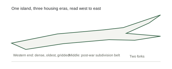
The first fact about housing on Long Island is not a housing fact. It is a shape. The island runs long from west to east and is narrow across, ending in two forks. Everything about how it was settled follows from that geometry and from the glacier that produced it.
The glacier set the terms
The island is glacial in origin: ridges of material left along the line where the ice stopped, with gently sloping outwash plains running south from them to the ocean. That gives the island a spine of higher, hillier, better-drained ground and a flatter, sandier south. The north shore is irregular, with deep harbours and bluffs; the south is straighter with barrier beaches and shallow bays behind them. Soil, drainage, water table and buildability all follow this division, and so, eventually, did the kinds of houses built on each.
Farms, harbours and estates
For most of its history the island was agricultural, with harbour villages where the water allowed a landing and the settlements arranged around the practicalities of farming, fishing and shipping. The oldest housing stock reflects that: modest, close to a village centre and a place of work, built with local labour and local proportions. A later period added large estates along parts of the north shore, taking advantage of the same harbours and views for entirely different reasons. Both left a stock of buildings out of proportion to the population that built them, which is why some village centres still feel older and denser than the suburbs surrounding them.
The railway made a commuter island
The decisive change was rail. Once it was possible to live on the island and work to the west, land near a station became qualitatively different from land two miles from one. Settlement organised itself into beads along the lines: a station, a small commercial centre, a walkable ring of housing, then thinner development. That pattern is still legible today and still priced. The distance from a station, and the frequency and duration of the service from it, remains one of the strongest predictors of value in the whole island, for the same reasons set out in what moves prices.
The post-war subdivision
After the Second World War the island became one of the defining places of mass suburban house-building. Farmland was subdivided at speed, houses were built to a small number of repeated plans, and an enormous quantity of similar homes appeared in a very short period. The consequences run right through the present housing stock:
- Whole neighbourhoods are the same age, which means their roofs, heating plant and services reach the end of their lives at roughly the same time.
- The original houses were small, so a large share have been extended, converted or dormered — which is why permit history matters so much here.
- The layouts assumed a car, and the street patterns were designed accordingly.
- The building type is standardised enough that comparisons between homes are unusually meaningful, which is rare in housing.
The eastward gradient
Reading west to east, the island moves broadly from dense, old and gridded, through the mid-century subdivision belt, into lower-density land, agriculture and the two forks, where seasonal and second-home demand behaves differently from commuter demand. The same island therefore contains several housing markets whose drivers barely overlap: one governed by commuting time, another by land and agriculture, another by a summer season.
Water, on all sides
Water is the island's permanent housing question. Drinking water comes from underground, which makes what happens on the surface a long-term matter. Waste water in much of the island is handled on individual properties rather than by public sewers, which shapes lot sizes and what may be built. And coastal exposure — storm surge, flooding, erosion and insurance — is a real and repricing factor for a great deal of the island's most desirable land. These are not historical footnotes; they are live constraints on what can be built and what it costs to hold.
What the history leaves behind
An island with a very large stock of similar mid-century houses, mostly altered; older village cores at the stations; a hard eastward gradient in density; and a set of physical constraints — water, drainage, coast — that increasingly determine where the next housing can go. Almost every question a reader will have about a particular home on the island lands somewhere in that inheritance.